Proprietary AI models for data extraction and downscaling
Capturing present and future climate risks and adaptation measures worldwide
Neutral networks trained on wide geospatial data forecasting location performance under multiple future scenarios
Custom-built cloud SaaS portal featuring analytics, visualizations and API access
Actionable
Metrics
Engineered
Features
Spatially
Indexed Locations
Unique
Data Points
Propstack's spatial index powered by AlphaGeo measures the resilience of every place in India
Complete spatial and temporal mapping of climate hazards and resilience infrastructure using the latest remote sensing data and object detection algorithms
Aggregate and analyze all data layers with a single click down to granular resolution under multiple timescales and SSP scenarios
Acquire novel insights from alternative datasets spanning macro, socio-economic, demographic and regulatory variables
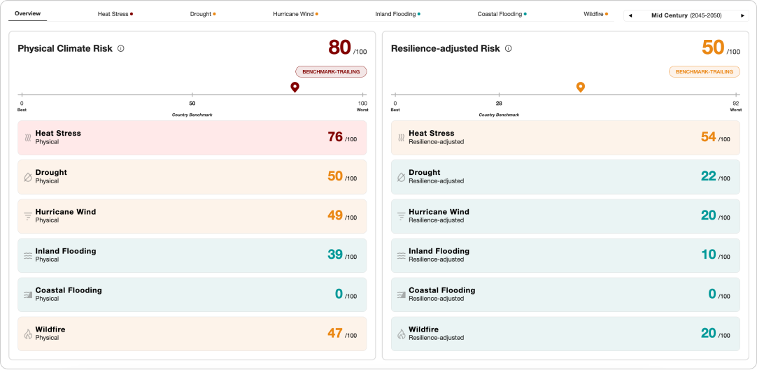
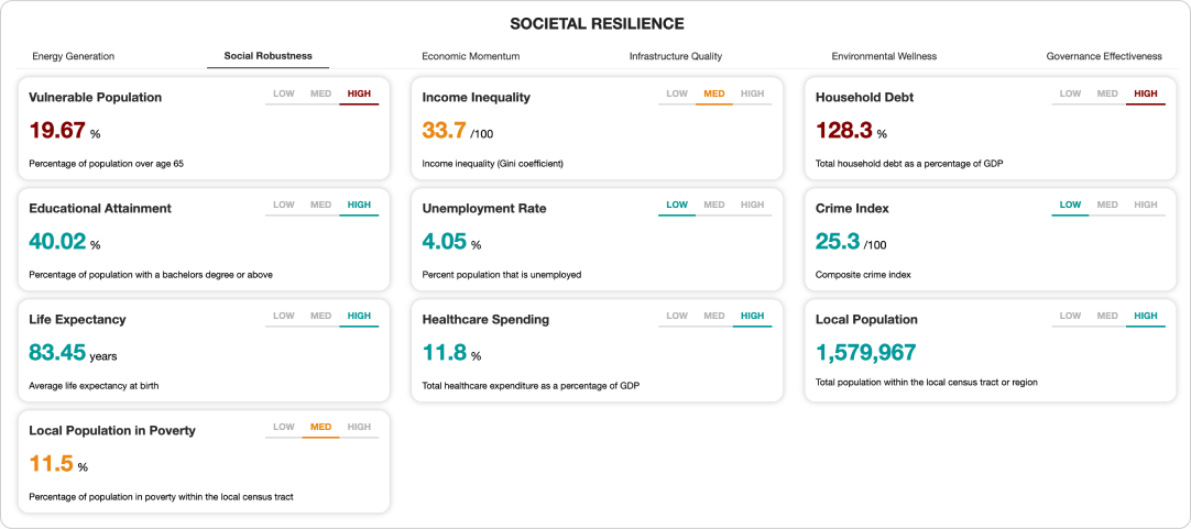
Propstack’s collects and harnesses an expanding database of structured and unstructured data across a wide range of categories (macro, geospatial, climate, socioeconomic, demographic, market, fiscal, migration, etc.), using our in-house feature engineering pipelines to extract explainable features from them via computer vision and natural language processing (NLP) algorithms. We leverage this data to provide resilience-adjusted risk scoring and location performance forecasts, giving a more accurate “ground truth” assessment of their capacity or preparedness to cope with disruptions.
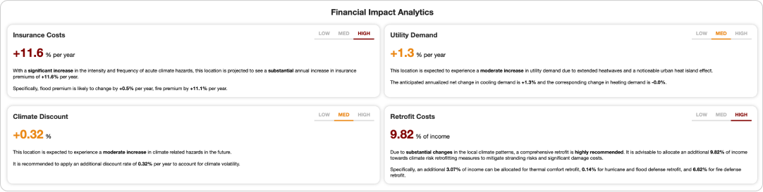
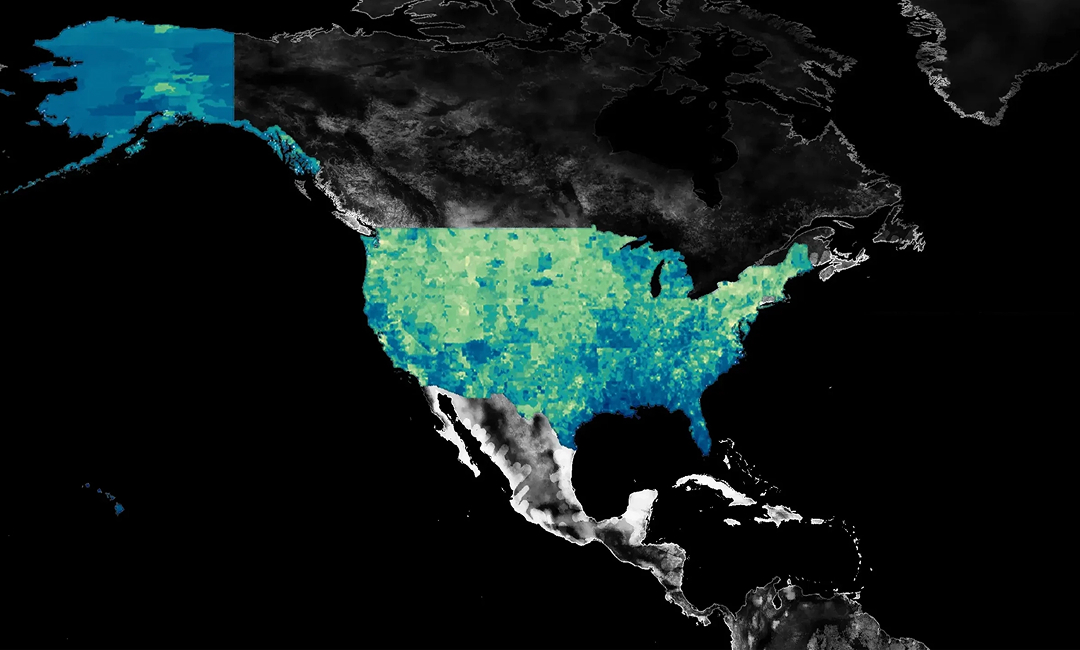
We employ proprietary methods to downscale the latest global climate models (GCMs) across six major hazard indicators (Heat Stress, Wildfire, Coast Flooding, Inland Flooding, Hurricane Wind and Drought) to the most granular coordinate level for every location on Earth. Each risk indicator is available for four different periods (2025, 2035, 2050, 2100) and four climate emission pathways (SSP245, SSP370, SSP585, and our proprietary “SSP X” acceleration scenario). Across the six risk indicators, we also provide the ~50 underlying feature datasets that determine the value of the individual risk scores.
Heat Stress

Wildfire

Coastal
Flooding

Inland
Flooding

Hurricane
Wind

Drought

2025, 2035, 2050, 2100

SSP245, SSP370, SSP585, SSP X*

National, province/state, country, city, postal code, census tract, address, coordinate
We utilize feature extraction algorithms to identify and geolocate local adaptation features pertinent to offsetting each climate hazard, giving a comprehensive assessment of a location’s capacity to withstand shocks.

DMGT (dmg :: information) is a global investor with a portfolio of high growth, innovative, must-have information media businesses in the property, education, energy and commodity and structured finance sectors. Their goal is to continue to identify, invest in and organically develop strong and differentiated b2b information businesses.

Real Capital Analytics, Inc. is a data and analytics firm with offices in New York City, San Jose and London. Started in 2000, the firm's proprietary research is focused exclusively on the investment market for global Commercial Real Estate.


Ready to Power your decisions with data?